As residents continue to clean up from Wednesday's storm, investigators with the Northern Tornadoes Project (NTP) from Western University have been on the ground assessing the damage.
NTP investigators have concluded that a tornado touched down in Blenheim and a downburst caused damage in Kingsville and Harrow on July 26.
Downbursts are powerful winds that descend from a thunderstorm and spread out quickly once they hit the ground.
Damage to power poles and trees was reported in the Harrow-Colchester area and eastward to Kingsville after a storm passed through around 3:55 p.m.
Damage was assessed as an EF1 downburst, with an estimated max. wind speed of 145 km/h.
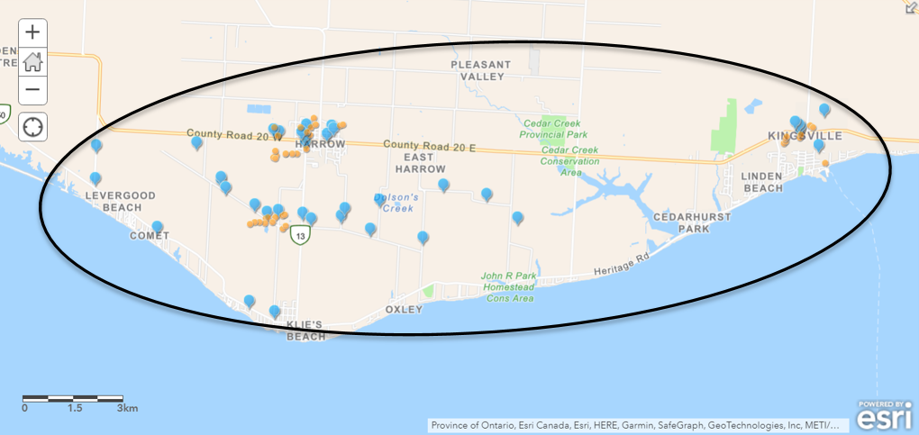
Map showing the location of the downburst that caused damage in the Harrow/Kingsville area, with blue pins indicating where damage was documented from the ground and orange circles indicating where drone images were taken. (Photo courtesy of NTP)
David Sills, Executive Director, Northern Tornadoes Project says when they got to town they knew where to start tracking the damage because of the sheer volume of picture tips they received.
"The number of photos we've been sent is just incredible from people in the area. I think we got over 100 photos that have been sent into us now with this. So the team definitely had a good idea of where to go."
He says apart from the damage to trees, barns and crops there was another key indicator that this was a serious weather event.
"It's the power poles that tell us that this was pretty serious as far as wind so it ended up with EF1 rating. The size of this is pretty impressive, it was like six kilometres wide by 22 kilometres long. So this was a wide-spread area of wind damage and unfortunately it was Harrow and Kingsville that were caught in the middle of it."
In Blenheim, NTP confirms an EF1 tornado cut through the northern end of town around 4:35 p.m. with damage to homes, sheds and trees.
An NTP ground and drone survey was completed on July 27, 2023, documenting a long narrow track of damage, including some crop damage.
Damage assessed as EF1 tornado, with an estimated max. wind speed of 160 km/h, track length of 9.77 km and max. path width of 300 m. Tornado motion was from the WSW (approx. 240 degrees).
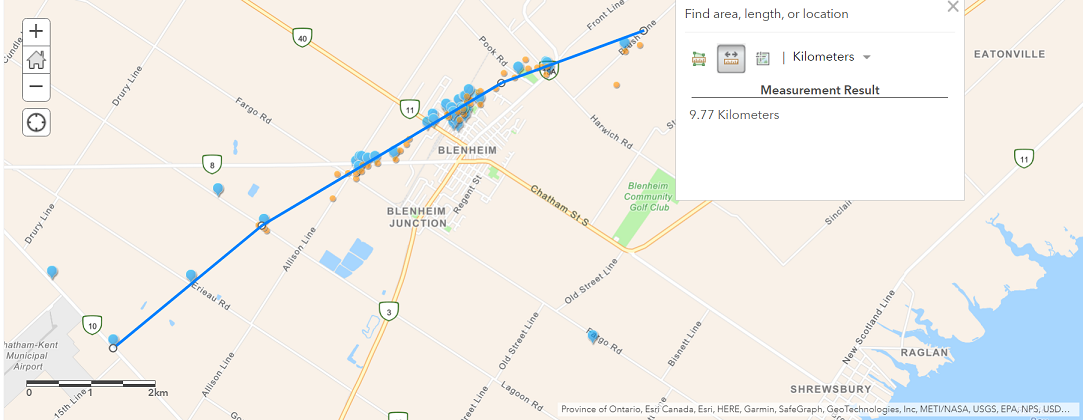
Map of tornado track through Blenheim, with blue pins indicating where damage was documented from the ground and orange circles indicating where drone images were taken. (Photo courtesy of NTP)
Sills says they have a number of tools, including drones, they use to determine if a tornado touched down.
"But really it helps to put that together with radar as well and luckily there's a radar at Detroit Metro Airport that was able to capture this at really high time resolution. So we could see that wind really punching right through that Harrow-Kingsville area and then the rotation developing in Blenheim. So really useful to put all that information together and then put the report together."
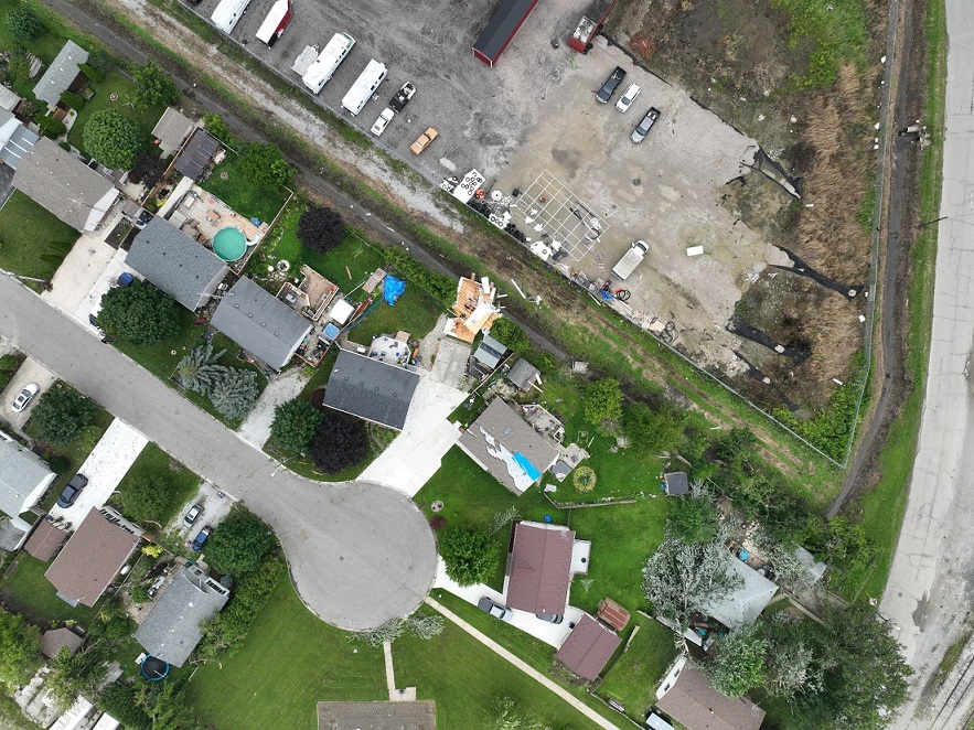
Drone photo of worst damage on Vander Ave in Blenheim. (Photo courtesy of NTP)

Tornadic swirl patterns in crops north of Mango Lane in Blenheim. (Photo courtesy of NTP)
-With files from AM800's The Shift with Patty Handysides